Astigan HALE Flies British Skies

Dean Sigler Batteries, Solar Power, Sustainable Aviation Leave a Comment

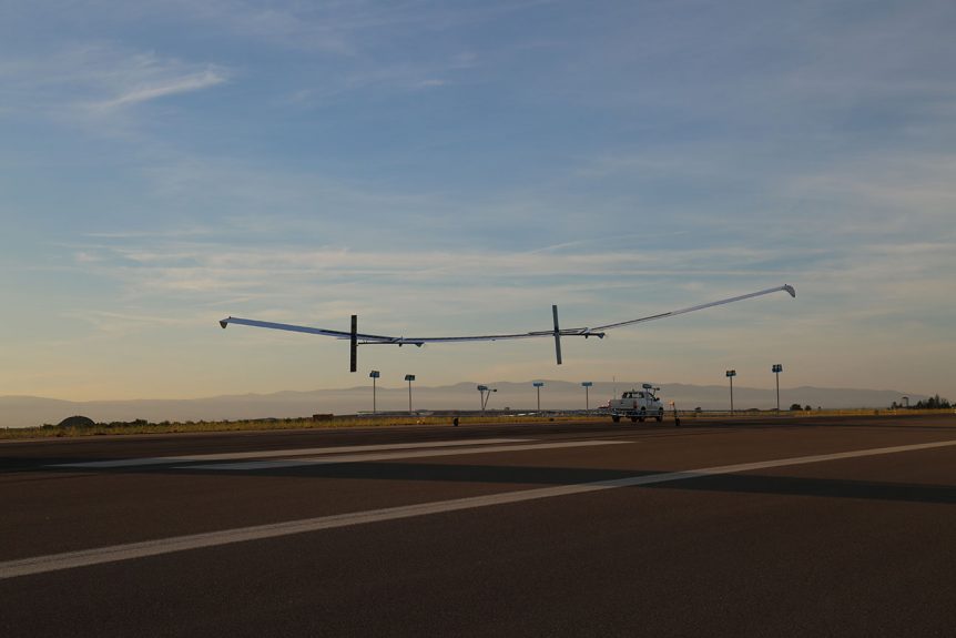
Ordnance Survey Established in 2014 by Ordnance Survey and private investors to develop and commercialize the UK’s first commercial sub-orbital Earth Observation High-Altitude Pseudo Satellites (HAPS), Astigan is both the aircraft company and product of that partnership with OS. Ordnance Survey produces maps for private, government and business users, including pre-printed print maps and custom charts downloadable to PCs or mobile devices.  These can be as elaborate as items containing “fly-throughs” of requested routes for hiking, biking, driving or even flying trips.  3D modeling enables users to visualize the terrain and essential elements before committing to a flight. Astigan HALE To enable accurate mapping and application development, the team has created a 38-meter (124.7 feet) wingspan, twin-motor high-altitude, very light machine that will not only chart the landscape, but provide data for environmental, analysis of changes in the geospatial landscape, monitor agricultural factors such as soil erosion or crop yield, provide a communication link in remote areas and in disaster …

eUP Looks Up and Downloads Data

Dean Sigler Electric Powerplants, Sustainable Aviation Leave a Comment

John McClintock, co-founder of eUP Aviation in Lumby, British Columbia, recently spoke with your editor on changes he and Randy Rauck are making to their Electravia-powered hang-glider trike.  They’ve recently campaigned Green1 up and down the Pacific Coast, demonstrating its self-launching and soaring capabilities over California deserts, at Torrey Pines, and in the mountains of Oregon. John was pleased to report that the trike came through that 7,700 kilometer (4,774 mile) bouncing trailer torture test with a perfect bill of health for the e-drive system and its installation. Not content to just enjoy their flights (which they did) the entrepreneur-engineers kept careful records of the details of each flight using an on-board Flytec 5030 hang gliding instrument to collect flying data, and their custom-specified Electravia data display and recording option to capture information for the e-drive system.  eUP Aviation Inc. have expanded the raw data into a Digital Journey Log, which will allow customers to demonstrate the care and use …