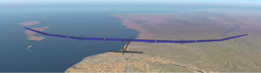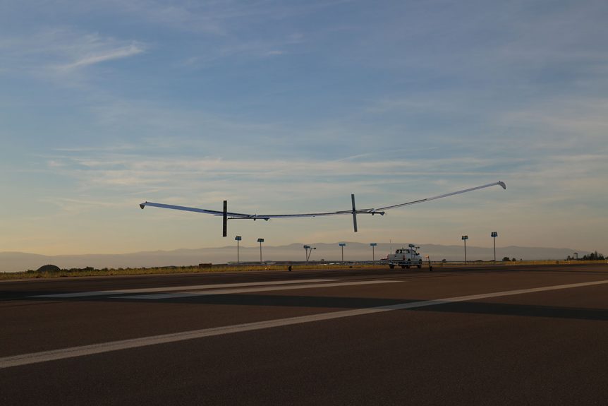
Flying high and down under, Amprius, the San Francisco Bay area-based battery developer and maker, announced 450-Watt-hour per kilogram cells, and seemingly immediately secured orders from three major clients. One client of the three is a British specialist in HAPS (High Altitude Pseudo Satellite) aircraft. A probably unrelated sale went to an Australian light plane maker unveiling the country’s “first commercially produced electric aircraft,” a two-seat trainer. BAE/Prismatic BAE Systems has collaborated with Prismatic, a HAPS pioneer, in the development of solar-powered unmanned aerial vehicles (UAVs). The partners have crafted two prototypes of the PHASA-35 unpiloted aerial vehicle, a 35 meter (114.8 feet) span airplane weighing 150 kilograms (330 pounds) capable of carrying a 15 kilogram (33 pound) payload. Solar cells power the craft’s electric motors during the day and charge the Amprius batteries that keep it in the air at night. Amprius claims, “The new 450 Wh/kg cells are the only known commercially available batteries of their kind that …